
Have you ever experienced this? You fire up Google Maps, following its instructions until you take a road and you suddenly realize that you get the wrong one? And if only Google Maps were more accurate…
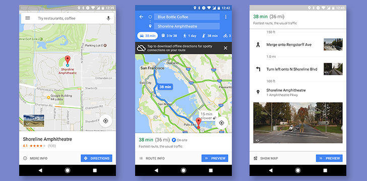
To solve this problem, Google Maps is adding pictures from Street View to improve their directions. The idea is that even if they provide precise indications, there may be times when they are confused and unclear, especially if we have never been in an area. Adding Street View images will surely prove useful. At this time, this feature is for Android devices only.
How does it work
If you have an Android device, the feature should already be there. Enter the destination, and during the route, you will notice thumbnails for Street View images (to the right of the direction of travel). If you are traveling by car, please use this new function with prudence and intelligence: focus first on the road and only then on your screens.